


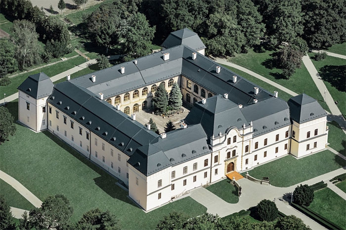
Mansion in Humenne - Vihorlat Museum
The beginnings of Vihorlat Museum's history date back to the year 1960 and are connected with the decision that the renovated manor house in Humenne will also serve museum purposes.We obtained the statute of Local History Museum in 1964. Since 2002, the founder of the museum is Prešov ...


")


Mining museum in nature
The Open-air mining museum is the oldest and thematically the most extensive mining exposition in Slovakia, which shows the development of ore mining in the Central European area from the Middle Ages to the end of the 20th century. It is located approximately 1 km from the city center under the Klinger tajch. The museum consists of a surface exhibition and an underground exhibition. Surface exhibition You can see the surface exposure for yourself. It presents the unique technical mining monuments of the Banská Štiavnica region, but also an Educational Geological Exhibition that presents the geological development of Slovakia on a small area. In the surface exhibition clearly dominates Kachelman's water column traction machine, relocated from the Lill shaft in Hodruša. It is a monument to the glorious era of water-column machines, which in the 18th century saved mining in Banská Štiavnica from extinction and stood at the forefront of technical progress on a global scale. Underground exhibition A tour of the underground is a unique experience. The sightseeing route will introduce you to the mining area from the 17th-19th centuries, old mining tools and equipments.The rarest exhibit in the underground exposition is the horse-powered „Gápel“, which is the only machine-motor from a mining elevator that has been preserved in Slovakia. We recommend booking the tour in advance and wearing suitable shoes and warmer clothes. You can find more information on the official website of the Slovak Mining Museum, where you can also find contact information and a reservation form: https://www.muzeumbs.sk/en/mine-museum-in-nature


")


")

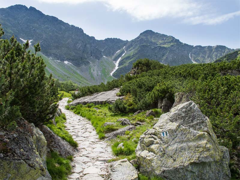
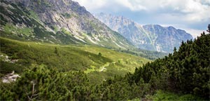
Western Tatras
Location
Western Tatras (in Slovak Západné Tatry) is mountain range in North Slovakia, in Žilina Region (Žilinský kraj) - district Liptovský Mikuláš.
Area
The area of mountains is 380 km2 (286 km2 in Slovakia and 94 km2 in Poland).
Highest peak
Highest peak is Bystrá (2 248,4 m. a.s.l.). ...
Batizov Mountain Lake
Batizov mountain lake (in Slovak Batizovské pleso) is lake in the Batizov valley (Batizovská dolina) below the foot of Gerlach peak (Gerlachovský štít) - the highest peak in Slovakia and High Tatras (Vysoké Tatry). It has max. depth 8,7 m and area 3,48 ha (0,03480 km²), its altitude is 1 884,2 m. a.s.l.. Below the Batizov mountain lake there are Batizov waterfalls (Batizovské vodopády).


")


")


